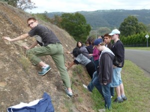
The Ashfield Shale directly overlies the Hawkesbury Sandstone which is prominent in the coastal cliffs and freeway cuttings in the Sydney area. It’s the lowermost of the three units that comprise the Wianamatta Group: the Bringelly Shale, the Minchinbury Sandstone and the Ashfield Shale.
The Ashfield Shale is composed of silty sediments in thinly laminated beds that extend laterally for long distances. As a fine-grained sediment, geologists in the past interpreted the formation as being deposited in a low-energy marine environment. The idea was that the water needed to be still for a long time to allow the fine grains to settle.
However, recent flume experiments have shown that fine grained sediments, such as clay and mud, deposit from moving water. To me, the wide, laterally-extensive, parallel beds suggest a high energy environment that spread the sediment across large distances.
The shale exhibits a faint lustre indicating a slight degree of metamorphism and the cutting shows sets of vertical joints. These likely are related to the uplift of the Blue Mountain Plateau. The steep escarpment that rises to the plateau of the Blue Mountains can be seen in the distance from this site.
The geological sequence of the Flood can be clearly seen at this site: rapid sediment deposition, tectonic uplift, landscape erosion, post-Flood vegetation.
Phil Uebergang
Hi Tas,
I recently did the National Pass walk with my brother after heavy rains. Spectactular, the whole escarpment was one giant waterfall. A well travelled Swiss sister-in-law has described the Blue Mountain walks as among the best in the world. High praise indeed!
My brother put me on the spot asking how I thought the huge scallops had formed in the cliffs. After a bit of head scratching it came to me. They look like the remains of huge pot-holes from the early stages of post-flood runoff. So there you go – a new geological pot-hole theory. (It’s probably not new).