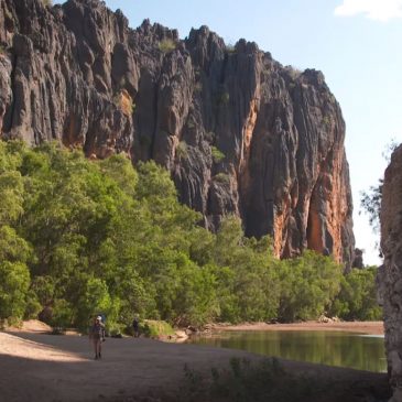
Windjana Gorge, Western Australia, was not an ancient barrier reef

Recently, a friend asked if I knew about Windjana Gorge in the north of Western Australia. He said, “It is on the Gibb River road in the Kimberley and the information there said the cliffs were a reef. It was … Continued
The Finke River near Hermannsburg, Central Australia, reveals evidence for Noah’s Flood

posted in: Landscapes, Noah's Flood | 0

The landscapes of Central Australia provide amazing insights into the way the waters of Noah’s Flood drained from the continent. Figure 1 from Google Earth shows the area immediately south of the mission station of Hermannsburg. The course of the … Continued

Ormiston Gorge, Central Australia

posted in: Landscapes | 0

The spectacular geology and landforms of the MacDonnell Ranges in Central Australia are graphically revealed in Ormiston Gorge, which cuts some 300 metres deep through a high ridge, around 135 km west of Alice Springs. The gorge exposes thick strata … Continued

Google Earth shows Appalachians were eroded by receding floodwaters

Further to my two recent posts these two Google-Earth images provide further evidence the Appalachians were eroded by the receding waters of Noah’s Flood. My first post presented a reinterpretation of a paper published in GSA Today (a publication of … Continued

Lead author challenges Noah’s Flood interpretation of Appalachians

Sean Gallen, lead author of the GSA Today paper about the uplift of the Appalachians, which I connected with Noah’s Flood has responded with the following comment. My response is interspersed. I am the first author on the article “Miocene … Continued

Appalachians eroded by receding waters of Noah’s Flood, new GSA paper shows

posted in: Geological History, Landscapes | 17

An interesting article, published in GSA Today (a publication by the Geological Society of America) in February 2013, describes features of the landscape of the Appalachian Mountains. These are a system of mountain ranges in eastern North America, extending from … Continued

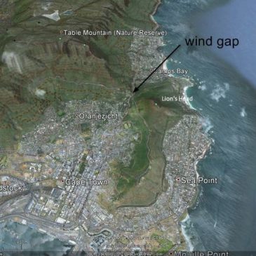
Google earth reveals ancient flow channels through mountains on Cape Peninsula south of Cape Town, South Africa

posted in: Landscapes | 0

Here are some Google-Earth images of the Cape Town area, prompted by reading an article on Yahoo! News entitled African Mountain Range Could be World’s Strongest. The researchers calculated erosion rates for the mountains based on measuring radioactive isotopes of … Continued