I’m wondering if you know of any Christian geologists, specifically in NSW, that may be interested in helping me with information about a geological formation at Mooral Creek, north of Wingham, that the locals say is a volcanic plug, but I cannot see any evidence of igneous rocks at the locality. I would love some more verifiable details on what it actually is, and hopefully a geologist would be able to assist me in that.
Dear GC,
You can find a lot of good information from relevant geological maps available on the web.
Go to the Geoscience Australia page where you can download geological maps online:
Find the geological map of the area, which is the Tamworth-Hastings composite.
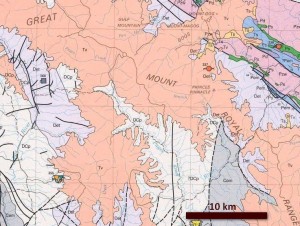
On the map find Wingham. You will see that about 1 km north of Wingham is an oval tan area labelled Ta (‘T’ for Tertiary, ‘a’ presumably for trachyte). This is probably the volcano they are talking about.
Notice on the map that the area has lots of faults running through it in a north-west to south-east direction. This is part of the New England Fold belt in which the rocks have been pushed around and uplifted.
You will notice also large tan-coloured areas on the maps that are labelled Tv (for Tertiary volcanics). These areas are the remnants of a huge basalt eruption that flowed over the area toward the end of Noah’s Flood. (You can see that they have flowed across the faulted rocks that are underneath.) After the eruption of the basalt, which covered a much larger area than it does now, the lava flows were severely eroded and dissected by the receding floodwaters. These also eroded the landscape.

“While the Floodwaters were receding volcanic eruptions occurred (caused by earth movements that produced heating, pressure and cracks in the crust). These eruptions now form basalt caps along eastern Australia such as the well-known plateaus near Brisbane such as Lamington Plateau and Maleny Plateau. Eruptions during this time also formed volcanic plugs such as the Glasshouse Mountains and Mt Warning. The land around these plateaus and mountains was eroded away by the final stages of the receding floodwaters, leaving them exposed as spectacular landmarks.”
The rhyolite plug north of Wingham may have erupted at the same time as the basalt, similar to the Glass House Mountains in Queensland. Or the plug may have erupted earlier like the diatremes in the Sydney area (search for diatreme in the article). This rhyolitic volcanic plug has been eroded down to a similar elevation as the rest of the countryside.