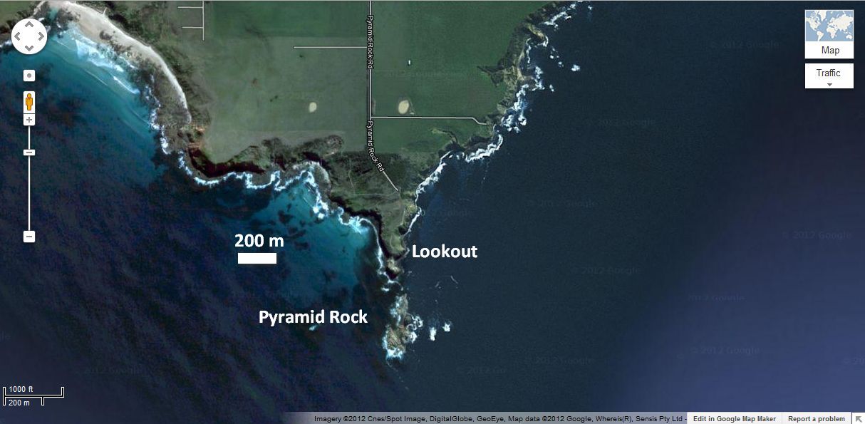
KEY SITE. From Back Beach Road turn south into Pyramid Rock Road and drive 3 kilometres along an unsealed road to the carpark at the end. Walk south along a boardwalk to the lookout at the top of the cliff where you have a clear view of Pyramid Rock in the distance in the ocean. There are toilets at the carpark.
This is one of the three so-called KEY SITES identified in the excursion guide. By visiting and understanding these three sites you will have a good appreciation of the geology of Phillip Island and southern Victoria. The three sites are:
- Site 6—Pyramid Rock;
- Site 9—Cape Woolamai Beach and
- Site 13—Bonwicks Beach, San Remo.
These three sites are suitable for individuals and groups (such as a school excursion or church youth group). All three could be visited in a morning or afternoon.
As you walk along the boardwalk you can see columnar jointing in basalt flows at the base of the bluff. From the lookout you can see Cape Woolamai to the east. You can also see that Pyramid Rock, like The Nobbies visible to the west, is a tumbled outcrop of basalt rock, which is part of the Older Volcanics. The columns comprising the basalt flow are still visible. The pyramid was once connected to the main basalt outcrop in the foreground on Phillip Island giving an idea of the huge area of land covered by the flow of molten lava and the amount of erosion that has occurred since the basalt rocks solidified. Something of the depth of a single lava flow can be judged by the length of the columns.
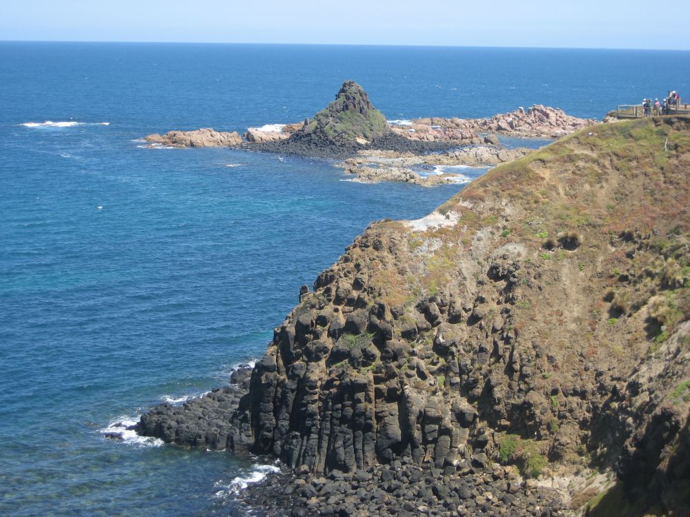
Check the steep bluff and the promontory on which you are standing. Noticethere are pale-coloured, sandy patches in the foreground between the basalts and in the grass underneath the lookout. Are you able to see that the pale gravelly material is composed of slightly angular quartz fragments and whiteish clay (kaolinite). (Make sure you don’t do anything dangerous to look at this material.) This pale material is the typical product of the breakdown of granite. In other words, the white material likely came from erosion of the Woolamai granite.

This indicates how there had been kilometres of erosion which exposed the granite plutons at the surface before the the basalt lava erupted and flowed on top of the granite. In places the basalt flowed over sandy sediments and in other places sandy sediments were washed over the top of the lava flows.
Significance
From geological sites like this, geologists can see that considerable erosion occurred before the basalts erupted. For a start, all the sediments that the granite intruded into, as well as those sediments that sat on top of the pluton, were eroded away—likely kilometers of material. Were there some sediments of the Strzelecki Group that were eroded away too or were these sediments never deposited in this area? The continent-wide movement of water during Noah’s Flood can account for such erosion. This site also suggests that the black volcanic lava was erupted as the floodwaters of Noah’s Flood were receding from the continent into Bass Strait.
Guide available as a booklet
This entry is taken from the geological excursion guide for Phillip Island. The complete guide is available as a booklet on creation.com Aussie store.